
People on the East Coast sometimes say weird things when they learn you’re from California, especially southern California. Complete strangers will just start talking about why they could never live there. The people, so they tell you, are very shallow and image-focused. No one does serious work. How could you live without seasons? Autumn is just so lovely. The traffic would be unbearable, etc., etc. This behavior can all be chalked up to a very reasonable inferiority complex.
But people also express fear. Specifically they are afraid of two things: earthquakes (primarily), and wildfires (increasingly). These fears have always struck me as a little funny. Earthquakes and wildfires are not that deadly in relative terms, at least not in the U.S. and in recent history. Earthquakes, for example, have only killed around 130 people in the U.S. in my lifetime, and 120 of those are from the Loma Prieta (1989) and the Northridge (1994) quakes. I have personally slept through many detectable quakes. Of course, there have been devastating earthquakes—and resulting tsunamis—with much higher death tolls in other countries. But for most Californians, earthquakes usually register somewhere between interesting and a bit annoying.
Wildfires are similar. Though the past few years have been especially deadly—more than 130 deaths in 2017-2018—wildfires rank relatively low on the scale of fatal natural disasters, though they do cause considerable property damage. Between 1970 and 2004, there were 84 wildfire deaths in the U.S. In the same period (which predates both Katrina, 1,833 deaths, and Maria, 3,057 deaths), hurricanes killed 304 people, tornadoes killed 2,314, and winter weather killed 3,612. Earthquakes and wildfires are no fun, but the eastern U.S. is where the weather kills you.
Strangely, almost no one ever remarks on the scariest of the weather events Californians experience: the drought. Droughts in California feel less like events and more like extended states of misery and dread. Since 1986, the state has spent approximately 15 years in severe drought. And the non-drought years have been far from comfortable. When I was a kid, my grandfather worked for the local water company and maintained drought protocol at all times. “If it’s yellow, let it mellow” was strictly observed. My sense-memory will forever connect the pink of my grandparents’ bathroom with the smell of old piss.
Part of this was due to my hometown’s particular vulnerability to drought. Santa Barbara’s main freshwater source is Lake Cachuma, which is a reservoir on the Santa Ynez river. The reservoir was created with the construction of the Bradbury dam in 1953, and it feeds Santa Barbara’s water system via a single, seven-foot wide concrete tunnel. But extended droughts can put enormous pressure on the lake. In 1991, Lake Cachuma was down to only 10 percent of its capacity. In a panic, Santa Barbara built a massive desalination plant to convert seawater into drinkable water. But the plant was finished right as the 1992 El Niño arrived and brought the lake back up to near capacity. The plant sat dormant until 2017, when another drought brought Lake Cachuma down to 7.3 percent capacity. At that point, the city fired up the extremely energy-intensive process of pumping seawater at very high pressures through membranes to force the salt out. This is called “reverse osmosis desalination,” if you’re curious. It’s expensive and difficult—the water has to be pushed through the membrane at pressures from 800-1,200 pounds per square inch(!) and only around 50 percent of the water is recovered—but it’s cheaper and easier than distillation. As of March 2019, Lake Cachuma is back to 78 percent capacity, but Santa Barbara’s desalination plant is still supplying approximately 30 percent of the city’s water.
Droughts in California and throughout the west are deadly to more than just olfactory memories and city budgets. Droughts and their accompanying heatwaves in the U.S. directly killed more than 3,900 people between 1970 and 2004. And the counts are much higher if you count the impact of increased air pollution from lack of rain. There’s also the death toll in the forests. Over 100 million trees died during the 2011-2017 drought in California. These drought-killed trees serve as tinder for more and more dangerous wildfires, which can also lead to deadly mudslides.
I expect a large reason East Coasters don’t ask me about droughts is that they just never think about them. When it comes to freshwater resources, the United States is made up of two completely separate countries, and those countries have very different water problems. The official dividing line has long been the 100th meridian, which bisects the Dakotas, and runs through Nebraska, Kansas, Oklahoma, and Texas. Average yearly rainfall east of the 100th meridian is more than 20 inches per year, while west of the meridian it’s less than 20 inches. (As the climate changes, this line shifts eastward. There’s reason to suspect that the current dividing line is closer to the 98th meridian.) Effectively, what this means is that in the east, water is plentiful. Farms can survive without major irrigation projects. There are innumerable rivers, streams, inlets, and lakes. There is almost no freshwater scarcity.

That’s not to say the eastern U.S. doesn’t have water problems, only that they’re different. Fracking and strip-mining pollute freshwater supplies. Cities and counties refuse to build infrastructure for freshwater delivery to some communities, especially poor and Black communities. Aging and ill-maintained infrastructure means that in Flint, just a stone’s throw away from some of the largest freshwater resources in the world, people are being poisoned. And at the same time, eastern water companies have been squeezing poor and especially Black residents with ever-rising water bills and ever-intensifying enforcement methods, including foreclosing on people’s homes when they can’t afford to pay for their water. But these are all management and delivery problems. The water is there, it’s just a matter of getting it delivered to people in a safe, affordable, and non-discriminatory way.

The west is a different story altogether. And if we can’t manage to solve the problem of safe and affordable water in places where water is plentiful, you can imagine the problems that arise when real scarcity is involved. Water history in the west is a full-service crash-course in all of 19th- and 20th-century American capitalism’s very worst tendencies. We encountered a scarce and necessary resource, understood exactly how scarce and necessary it was, then proceeded to kill each other for the chance to turn as much of it as possible into profit before all of it was gone. Now, in 2019, it’s mostly all gone and the west is burning.
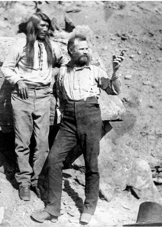
The prophet of water in the west, the man who foresaw nearly every issue we’ve struggled to deal with in the last 150 years, is John Wesley Powell. What’s the best way to describe Powell? Well, to start, he was an absolute madman. Imagine a one-armed Civil War veteran turned college professor who, in 1869, decides to take four boats down the Green River, into the Colorado, and through the Grand Canyon. At the time, no one had even come close to achieving this feat. Some white settlers had seen or boated various parts of the river—a few had witnessed the Grand Canyon from the rim—and native communities had lived along some parts of Powell’s route. But, to the best of anyone’s knowledge at the time, not even the natives had attempted this entire trip by boat. The rivers were truly unknown and unknowable to Powell. He could have encountered a waterfall as extreme as Niagara Falls at any point along the way, and died instantly. And, to compound this uncertainty, Powell undertook the journey in four wooden boats, never having run a rapid before, with an entire crew of men who had also never run a rapid before.
Somehow, Powell and most of his crew survived the three-month journey. Those who didn’t survive couldn’t exactly blame Powell for their fate. At the top of a truly massive rapid in the Grand Canyon, three men abandoned the expedition, thinking they’d have better survival odds hiking than trying to run these rapids in their tender wooden boats. Only two days later, Powell and the remaining crew finished their journey, having run the intimidating rapids without issue. The three who’d abandoned them had already harassed a band of natives near the rim of the Grand Canyon and been killed.[1]
The journey is what Powell is famous for, but his later reports are what make him a prophet of water in the west. Before Powell’s time, many Americans had largely written off the western U.S. as useless. In one of the best examples of a mislaid prophecy, an Army lieutenant, on seeing the Grand Canyon, reported:
The region last explored is, of course, altogether valueless. It can be approached only from the south, and after entering it there is nothing to do but leave. Ours has been the first, and will doubtless be the last, party of whites to visit this profitless locality. It seems intended by nature that the Colorado River, along the greater portion of its lonely and majestic way, shall be forever unvisited and undisturbed.
But by the 1870s, westward expansion was in full swing. Powell saw the gradual changes in the names on maps—the area labeled “Great American Desert” moving farther west as speculators and railroad companies encouraged people to make a go of farming west of the 100th meridian. Areas that were once labeled “Great Desert” were increasingly re-dubbed “Great Plains,” and throughout the 1870s, (paid) scientists were pushing some absolutely insane theories to encourage people to move west. The most absurd of these may have been the “rain follows the plow” theory. Think Field of Dreams, but for farming. The idea was that once people started farming in dry regions, rain would naturally come. When you plowed soil, even very bad and seemingly un-arable soil, the plowing would just automatically release trapped moisture into the atmosphere. This was, of course, nonsense. At heart, the “great plains” and “rain follows the plow” were marketing slogans, an early instance of real estate developers rebranding a previously undesirable area to turn a profit.
Powell’s reports attempted to show just how hopeless much of this project was. The Homestead Acts were granting western lands (to people but also to corporations, and with very high rates of fraud) in 160-acre tracts. This tract size made sense in the east where irrigation wasn’t necessary. But 160 acres was too large a tract to productively irrigate, and too small a tract to use as unirrigated land in the west. And, Powell calculated, even if you put every ounce of freshwater in the western U.S. to work irrigating farmland, you would still only be able to produce crops from 1-3 percent of the available land. There just wasn’t enough water.
The problem was complex, and so was Powell’s solution. He pushed for a slow, orderly, well-researched expansion of irrigated agriculture using publicly-constructed dams to collect and store water. And, rather than the eastern U.S. method of granting water rights only to those who owned land that touched the river or stream that the water came from, Powell suggested employing a use-permit system to regulate and trade water rights. (The land-adjoining water rights system is called “riparianism,” while the use-based system in the west is called “prior appropriation.” Read the Wikipedia articles for these and you will have learned a good deal of what they’d teach you in a water law class at a top law school.) Finally, Powell recommended organizing our political boundaries to facilitate the communal use and cooperative regulation of water resources. That is, he thought state boundaries in the west should conform to watersheds. This would mean that state governments and residents would have purview over their entire water system and wouldn’t have to fight with other states over upstream or downstream uses.
Two of Powell’s recommendations were implemented, though likely not in the way he would have preferred. In the early- and mid-20th century, the U.S. embarked on an epic dam-building spree. But much of this building was driven less by need for water storage and electrical power than by competition for funding between two giant federal bureaucracies. Marc Reisner’s exhaustive and surprisingly thrilling retelling of the battle between the Bureau of Reclamation and the Army Corps of Engineers in Cadillac Desert is the authoritative history on this point. Reisner documents decades through which the agencies battled to outmaneuver each other, spending billions to build thousands of dams just to make sure the other
agency didn’t build them first.
The beneficiaries of the dam-building extravaganza were largely agricultural interests in the surrounding areas. More dams than could possibly be justified meant relatively large water stores. A combination of the mythology around small American farmers and the reality of agribusiness lobbying power meant that agricultural interests could reap direct benefits from these federal projects, mostly through heavily subsidized water, power prices, and food control. Far from Powell’s vision of watershed-based communities managing their water resources according to their local best interests, government and industry joined forces to turn Powell’s somewhat communitarian or at least localist vision into a capitalist suicide pact. This is not to say that all dams are bad or unnecessary—they are a valuable water management and power-generating tool. But a lot of dams that exist right now are both bad and unnecessary.
The western U.S. also adopted Powell’s recommendation for a water rights system. Most of the west now uses a prior appropriation system for allocating water rights rather than a riparian system. This means that water rights are divorced from land ownership: Anyone who can access water can make a claim to it, and those claims operate on a first come, first served basis. So if water sources dry up, the senior rights holders are the most protected, while newer users are left out to dry, both figuratively and literally.
Like dams, this is not an unreasonable system on its own. But it has combined with crafty capital and legal maneuvering to disastrous effect. First, to hold your water right, you have to use it. This means that nearly all water is going to get used, because there’s no formal protection (in the system as first conceived—things are slightly better now) for letting water run its natural course. Throughout the west, water systems have seen the complete loss of native wildlife populations and increasingly compromised water supplies, as water is taken out of rivers to irrigate land and returned to the water system in lower quantities and with higher salt content.
Second, water rights can be purchased and the water diverted far away. This is what allowed someone like William Mulholland in Los Angeles to buy up the entire Owens River and divert it to the San Fernando Valley, turning the Owens River Valley from “the Switzerland of California” into a desert, drying up Owens Lake, and massively increasing the value of Mulholland’s own properties in San Fernando. The battles over the Owens River are also covered in Reisner’s book. They involve spies within the Bureau of Reclamation, lies and grift and outright theft to obtain water rights, locals dynamiting the L.A. aqueduct, and Mulholland mustering an army of 600 gun-toting LAPD officers and transporting them hundreds of miles inland to protect his waterways. In case you’re wondering how all that turned out, the Owens River Valley is still a desert, nearly the entire river goes west via aqueduct, and Mulholland Drive is one of the fanciest streets in L.A.[2]
It should come as no surprise that Powell’s vision of cautious and sustainable water use in the west was never fully realized. An additional part of the puzzle that Powell failed to foresee was the use of groundwater. Massive underground aquifers underlie much of the U.S., and the western states have managed to produce agriculture in an area marginally larger than Powell’s 1-3 percent estimate thanks to the use of that groundwater. The problem, of course, is that groundwater is largely a non-renewable resource. Depending on the type of aquifer, it might recharge slowly or not at all. And the coastal aquifers, like the one underlying Santa Barbara, are at risk of seawater intrusion if they’re drawn down too low.
And have we managed this non-renewable resource in a reasonable way to preserve it for as long as possible? Spoiler: We have not. In fact, officials in charge of regulating groundwater have always been well aware that it was a non-renewable resource, and decided to exhaust it anyway. The former head of the Colorado Water Conservation Board described their decision to use the state’s groundwater supply over the course of 25 to 50 years like this: “What are you going to do with all that water? Are you going to leave it in the ground? . . . Well, when we use it up, we’ll just have to get more water from somewhere else.” The New Mexico State Engineer openly admitted the same: “We made a conscious decision to mine out our share of the Oglalla (aquifer) in a period of twenty-five to forty years.”[3] It has been more than 40 years since these programs started.
California is a particularly depressing example of harm wrought by greedy water policies. Groundwater extraction in California has been largely unregulated for most of its history, and as a result the central valley of the state is literally sinking. The entire valley is estimated to have sunk more than 28 feet since the 1920s, with some regions having sunk much more than that.

The use of these water systems as profit engines for private industry has not abated. Some of the largest groundwater extractors in California these days are not even farmers—they’re oil companies. California droughts result in severe restrictions imposed by municipal water departments, which levy steep fines against people for overusing water at home. Meanwhile, 80 percent of water use in California continues to come from agriculture and big business.
The brazenness of these government subsidies to agribusiness is particularly apparent in the Yuma desalination plant. The Treaty of Guadalupe Hidalgo, signed after the Mexican-American War, guarantees Mexico a certain volume of water from the Colorado River. But massive agriculture in the U.S. portion of the Colorado watershed meant that the water we were sending to Mexico was too salty to use for irrigation and was actually destroying crops. As a result, the U.S. built the Yuma desalination plant to purify water as it crosses the border into Mexico. Running this desal plant costs nearly $500 per acre-foot[4] of water, and we use this plant to clean millions of acre-feet. But many of the upstream agricultural users, the ones who are responsible for the salt content in the water in the first place, pay less than $5 per acre-foot.[5] Farmers in Merced, in central California, paid around $17 per acre-foot of water mid-drought in 2015.[6] Meanwhile, residential users in San Francisco pay the equivalent of $773 per acre-foot,[7] plus a monthly service charge.
One might be tempted to blame John Wesley Powell for many of our woes. After all, he was the one who recommended the systems of dam building, irrigation, and transferable water rights that have rocketed us into this bleak moment. But one key to our survival might be Powell’s last recommendation: watershed borders.
The thing about political boundaries is that they have historically served military purposes. The border of my territory is as far as my army can reasonably reach, as affected by how far your army can reasonably reach. In practice, this meant borders often conformed to geographic features like mountain ranges and rivers. It’s hard for me to cross the river to attack you, and it’s hard for you to cross the river to attack me, so the river is our border. In the U.S., we have continued to use geographic features like rivers as internal borders. There does not appear to be a logic behind this other than it’s a way people have always drawn borders.
Where U.S. internal borders aren’t rivers, they’re often straight lines. This has some obvious appeal—it’s very easy to negotiate using straight lines. “54°40′ or fight”[8] has a nice ring to it. Lines of latitude and longitude are calculable and visible on a map no matter the underlying terrain, so they don’t require too much surveying work to establish. But neither of these border-drawing methods—either doing what we’ve always done with rivers and mountains, or drawing easy straight lines—do much to help the actual function of the political bodies that operate within those borders.
For one, states mostly don’t need to worry about other states’ armies.[9] In fact, rivers make particularly poor borders between states because a primary purpose of our union is to facilitate interstate commerce, and rivers are natural barriers. But, more importantly, rivers are an important natural resource, especially in the west. And rivers don’t respect borders. This is why California, Nevada, and Arizona have to continuously negotiate and update a giant contract about how much of the Colorado River each of them gets to use. It’s why the U.S. and Mexico have to negotiate and re-negotiate agreements about how much of the Colorado will flow into Mexico and what its salinity will be. And it’s why the longest continuous litigation in the U.S. legal system is an attempt to determine who has rights to use water in a particular river. (The Gila River adjudication is a 44-year-old lawsuit involving 32,000 parties with 57,000 claims to the same water source.)[10]
States or even local jurisdictions could avoid a lot of conflict and unnecessary bureaucratic wrangling if they simply drew their jurisdictional lines by watershed, just as Powell suggested. Watersheds, you may remember from a life science class at some point, are areas in which all runoff water ends up in the same place. Every river, stream, lake, and puddle has a watershed. The continental divide splits the Pacific’s North American watershed from those of the Gulf of Mexico and the Atlantic. If you pour some water on the ground, and that water eventually ends up in a river, you are in that river’s watershed. Because of gravity, watersheds tend to consist of valleys or basins, with the edges running along ridges.
When your border is a river, as between California and Arizona, you have the exact opposite of a watershed border. Both states contribute to the health of the river, and both will often fight, politically and sometimes physically, to use as much of its water as they can. If a state is part of a river’s watershed but has no access to that river, its residents have little incentive to keep the river healthy and might be more inclined to pollute, since someone else will bear the cost. A system of political boundaries based on watersheds, in addition to avoiding conflict, would allow states to more consistently regulate and protect their surface and groundwater resources.
Obviously, not every river, stream, and puddle in the U.S. should have its own state. And there are likely logical divisions for the same river, like the upper and lower basins of the Colorado, to avoid very large rivers with huge watersheds spawning super states. Powell himself proposed a system of state boundaries that balanced watershed management with manageably-sized states, and produced a beautiful map of an alternative western U.S. in the process. We needn’t use Powell’s exact map—others have attempted the same task with more up-to-date information (though, if we’re redrawing state lines, there’s little reason to stick to 50 states). But watershed organization doesn’t have to stop at the state level. Counties and cities could be organized around shared water resources, be they smaller rivers, streams, or groundwater aquifers.

Powell’s vision was a locally and efficiently managed water system, one that took into account the peculiarities of each watershed and river system, allowing those most immediately affected to decide how the resources should be allocated. The system that we ended up with, however much certain pieces of it resemble Powell’s plan, is just the opposite in philosophy and practice: The federal government spends billions on top-down projects motivated by pointless rivalries or desire to grant corporate subsidies, while domestic uses and the environment pay the price.
Fresh water is a precious and scarce resource, especially in the west. It’s the sort of thing that demands the most democratic control, but has historically been subject to the least. The stakes couldn’t be higher. Droughts in the west are becoming more frequent and last longer. The droughts kill trees, which fuels wildfires. The wildfires remove vegetation, which means more rainwater (when and if it ever comes) runs off, bringing deadly flows of mud along for the ride. Big earthquakes that might happen once every few hundred years get terrifying New Yorker profiles, while drought conditions that kill thousands stay well below the national radar. To say that the freshwater status quo in the west is unsustainable would be an understatement. Democratizing water is a big project—much bigger than redrawing some political boundaries. We have to enact a massive shift in power and control from capital to local people and political organizations. But watershed borders would probably be a good start.
[1] Reading about Powell’s expedition is really fun. A good recent book on the subject is Edward Dolnick’s Down the Great Unknown. He pulls great excerpts from the journals of everyone on the trip, many of whom were delightfully expressive in their disdain for Powell. For example, here’s George Bradley on Powell’s choice of campsite one night: “The Major, as usual, has chosen the worst camping-ground possible. If I had a dog that would lie where my bed is made tonight I would kill him and burn his collar and swear I never owned- him.”
[2] In the 1970s, L.A. came back for more, building a second aqueduct to transport mostly groundwater from the Owens River Valley down to the city. Decades of lawsuits followed. Meanwhile, the valley has gotten even drier and more barren as plants that rely on groundwater have died.
[3] Quotes as reported in Cadillac Desert.
[4] An acre-foot is a fairly standard measure of water, especially for irrigation. It sounds kind of cute, but it’s actually huge: It’s the amount required to submerge an acre of land in a foot of water. That’s a little more than 325,000 gallons.
[5] For those keeping track, this is approximately 1/1,000 of 1¢ per gallon.
[6] About 1/200 of 1¢ per gallon.
[7] About 1/4 of 1¢ per gallon, nearly 50x what the Merced farmers pay.
[8] 54°40’ is a latitudinal line in the Pacific Northwest, at approximately the southern tip of Alaska. The U.S. and Britain fought over the Oregon territory for several decades in the early 1800s. U.S. hardliners pushed for the U.S. to annex the entire territory up to the then-Russian border (Russia controlled Alaska), including what is now British Columbia. Hence the slogan “54°40’ or fight.” The dispute ended with the U.S. annexing only up to the 49th parallel instead, which marks the U.S.-Canada border today, and leaving British Columbia with the Brits.
[9] Mostly. But there was a point at which California and Arizona nearly went to war over the Colorado River itself. Arizona was displeased with its 1928 allotment of only 28 percent of the lower Colorado River (compared to California’s 59 percent). Arizona was even more displeased in 1934 when the Bureau of Reclamation began construction on the Parker Dam, a dam on the Colorado River that would span the border between California and Arizona, creating Lake Havasu, current home of the old London Bridge. California had already begun building the aqueduct that would carry its share of the lake water away. Arizona saw that once the dam was built, and the water was owing, its negotiating position would be permanently weakened. So, in November 1934, the governor of Arizona declared martial law. Arizona National Guard troops occupied the dam construction site, and the governor mustered an “Arizona Navy” (made up mostly of ferry boats, but commanded by a governor-appointed Admiral) to halt construction of the dam. The Arizona Navy got fouled up in some construction equipment, had to be rescued, and the war ended with no shots fired. The dam was completed a short time later.
[10] States and nations aren’t the only levels of political jurisdiction where water causes conflict. Most notably, tribal governments in the U.S. have been fighting for sufficient access to fresh water for hundreds of years. One of the most influential water law cases, Winters v. United States, cemented tribes’ rights to enough water for self-sufficiency and sometimes for agriculture on reservations. And more recently the fights against the Dakota Access Pipeline have been led by water protectors, who see their primary role as protecting the affected communities’ access to clean water.
